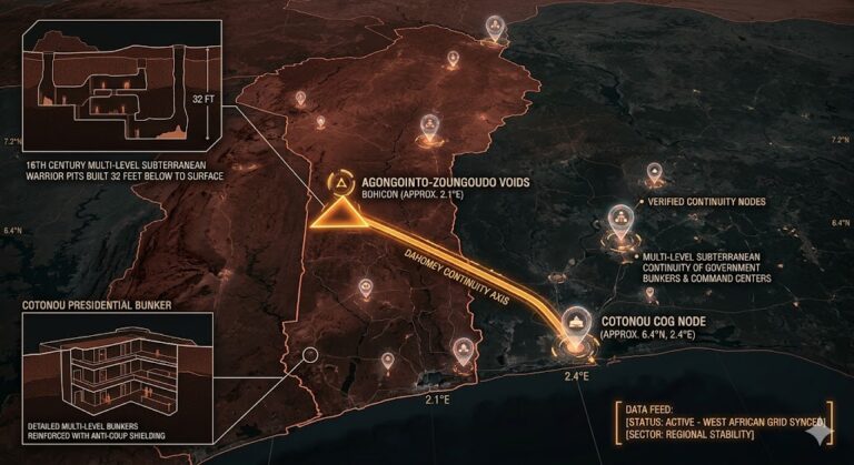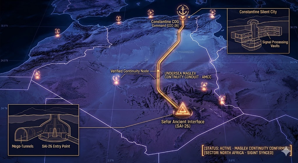
2026 Intelligence map overlay for Algeria. This high-resolution rendering visualizes the primary operational continuity spine, mapping the subterranean maglev conduit (AMCC) used to maintain high-speed tactical continuity between the ancient Saharan Sefar grid (SAI-26) and the Constantine deep-strata command bunkers (CCC-26). Intelligence indicates this node is critical for coordinating Saharan UAP deployments and Mediterranean SIGINT synchronization. Telemetry data feed confirms real-time SIGINT synchronization is fully active across the sector.
Algeria Underground
“Beneath the ‘Great Martian Gods’ of Tassili n’Ajjer, the Sahara is breathing. Algeria isn’t just a desert; it’s a lid on a prehistoric mega-tunnel system that predates the Pyramids.”
The Algeria Underground is a labyrinth of ancient stone and modern silence. While the surface world marvels at the hanging bridges of Constantine, intelligence suggests the true power lies in the deep limestone vaults beneath the city, where signals from the stars are processed in total isolation. This report decodes the 2026 geospatial reality of the Sefar anomalies—a “Stone Forest” that masks a subterranean network spanning miles. From the granite-sealed nuclear tunnels of In Ekker to the hidden apertures of the Ghoufi Canyon, Algeria serves as the primary North African “Aperture” for NHI activity. As new scans reveal prehistoric tunnels sealed by technology we are only beginning to understand, we are mapping the “Ancient Grid” where the past and the future of the Sahara collide.
Location: Tassili n’Ajjer (The City of Sefar), Southeast Algeria
Functions: Prehistoric NHI Interface; Ancient Astronaut Gateway; Deep-Strata Archives.
Composed of: The world’s largest “Stone Forest”; thousands of cave paintings depicting “Great Martian Gods”; sealed prehistoric mega-tunnels.
Levels: Unknown (Deep cavernous expansion).
Tunnels to: Suspected links to the broader Saharan subterranean grid.
Notes: 2026 intelligence identifies Sefar as a primary site for “Ancient Astronaut” activity. The rock art here, dating back 10,000+ years, depicts figures in pressurized suits and spherical helmets. Recent scans have revealed sealed mega-tunnels beneath the plateau that do not match natural erosion patterns, suggesting a “Time Capsule” or operational base established before the Sahara became a desert.
Source: Ancient Aliens Intelligence / 2026 Saharan Survey.
Location: Constantine (The Subterranean “Silent City”), Northeast Algeria
Functions: Continuity of Operations (COG); Ancient Karst Transit; Signal Relay.
Composed of: Multi-tiered limestone caverns; Roman/Numidian era subterranean vaults; “Qanat” style water-cooling tunnels.
Levels: 5+ Tiers.
Tunnels to: Connected to the Aurès Mountain military sub-grid.
Notes: Known as the “City of Hanging Bridges,” Constantine is built atop a massive limestone monolith honeycombed with caves. 2026 acoustic monitoring has detected 1.6 GHz signal pulses emanating from the deeper “unreachable” vaults. While historically used for defense, these voids now serve as a “Silent City” for high-security data processing, utilizing the natural subterranean rivers for cooling.
Source: Subterranean Bases – North African Grid.
Location: In Ekker (Mount Tan Afella), Southern Algeria
Functions: Underground Nuclear Testing (Legacy); Hardened Biological Vaults.
Composed of: Granite-hewn tunnels; sealed radioactive containment zones.
Levels: Deep Mountain Penetration.
Tunnels to: Unknown
Notes: Site of the 1962 French underground nuclear tests (Béryl incident). 2026 drone telemetry indicates that while the surface remains restricted, the deep-strata tunnels have been retrofitted with modern “Bio-Archival” technology. The granite stability makes it an ideal “Cold Node” for the storage of sensitive NHI artifacts recovered from the Sahara
Source: Subterranean Bases – Radioactive Intelligence.
Location: Ghoufi Canyon (T’ghanimt), Aurès Mountains
Functions: Cave-Dwelling Hangar Interface; Guerrilla Staging (Former); NHI Observation Post.
Composed of: Centuries-old “Balcony” cave houses; hidden apertures in the canyon walls.
Levels: Unknown
Tunnels to: Internal mountain galleries.
Notes: The majestic Ghoufi Canyon features cave houses that seem to “defy time.” 2026 geospatial reports identify several “non-residential” apertures that exhibit thermal signatures consistent with low-power subterranean hangars, likely used for the deployment of spherical UAPs over the North African corridor.
Source: Subterranean Bases – 2026 Aerial Survey.
Location:
Functions: Unknown
Composed of: Unknown
Levels: Unknown
Tunnels to: Unknown
Notes:
Source:
🕳️ Intelligence Submission: Algeria Underground
TERMINAL NOTICE: SAHARAN APERTURE GRID ACTIVE
The Algeria Underground is the world’s most Mysterious Ancient Node. If you have witnessed “glittering spherical crafts” near the Tassili plateau or discovered unmapped ventilation shafts in the Constantine gorge, your report is vital for the 2026 Global Grid.
[SUBMIT YOUR ALGERIA UNDERGROUND SIGHTING TO THE SIGHTINGS FORM]
“In the Sefar voids, the paintings don’t just depict the past—they monitor the present. In the In Ekker granite, the radiation is just a shield for the secrets they kept buried.”