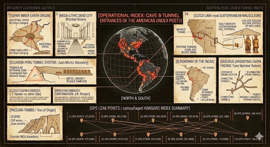
[ARCHIVAL DATA: 1970s OPERATIONAL OVERLAY] – A reconstructed vintage index of the first 10 primary subterranean entry points.
Cave and Tunnel Entrances of the America’s
The Cave and Tunnel Entrances of the Americas (frequently associated with the Branton Files) serves as a comprehensive geographic database for those investigating subterranean anomalies. This index catalogs hundreds of reported entry points—ranging from natural limestone caverns like Mitchell Caverns to the “Deep Underground Military Bases” (DUMBs) allegedly hidden beneath the Mojave Desert. The document serves a dual purpose: it provides a tactical guide for modern explorers seeking the physical evidence of a “hollow earth” and acts as a historical archive for indigenous legends, such as the Paiute tales of the Hav-musuvs who supposedly navigated the depths of Death Valley in “flying canoes” long before modern history.
In the context of the Secrets of the Mojave, this index is the operational map for the “Conspiracy Against Reality.” It categorizes entrances into categories such as “Natural/Ancient,” “Joint-Interaction (Human-Alien),” and “Black-Ops Military,” linking specific coordinates to whistleblowers’ claims of high-speed mag-lev shuttle terminals. By cross-referencing these physical locations with reports of “missing time,” cattle mutilations, and electromagnetic interference, the index attempts to prove that the American Southwest is a porous crust sitting atop a multi-layered, non-human civilization. It remains one of the most widely circulated pieces of underground literature for those looking to bridge the gap between desert folklore and modern military secrecy.
Cave and Tunnel Entrances of the America’s
Cave and Tunnel Entrances of the America’s 1 – 10
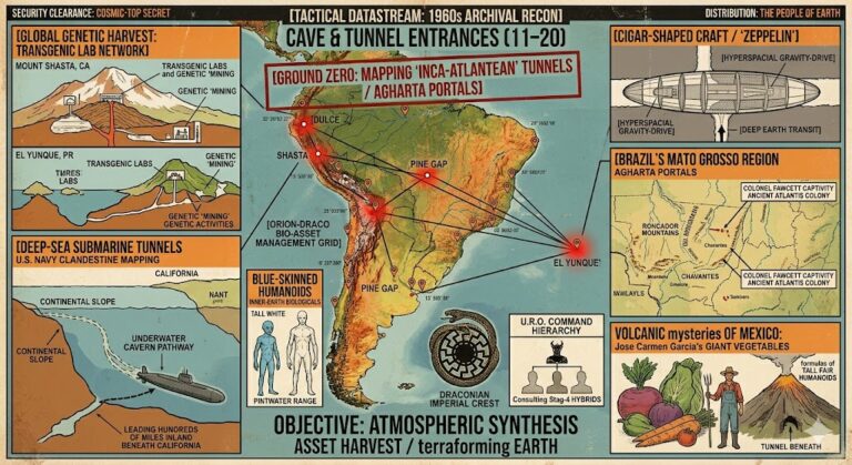
Cave and Tunnel Entrances of the America’s 11 – 20
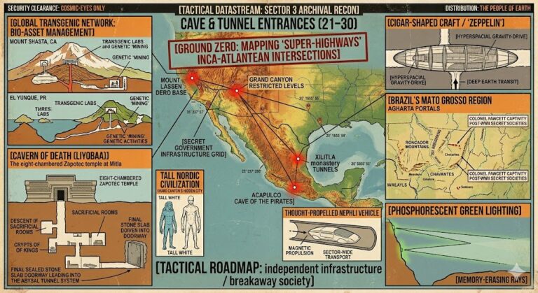
Cave and Tunnel Entrances of the America’s 21 – 30
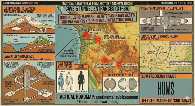
Cave and Tunnel Entrances of the America’s 31 – 36
The final takeaway from the Cave and Tunnel Entrances is that the boundary between our world and the “Inner Earth” is not a solid barrier, but a series of hidden doorways protected by those who fear the light of day:
“The map of the Americas is a double-sided coin. On the surface, we trace our highways and cities, but beneath them lies a labyrinth of ancient arteries and modern iron. To find an entrance is to realize that the ‘hollow’ isn’t just a theory—it’s a neighbor we’ve been taught to ignore, living just beneath the vibration of our own footsteps.”
The Branton Files: Entrances