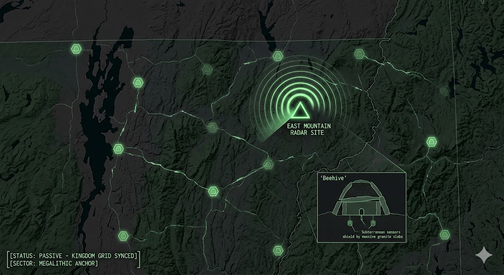
Vermont Underground “Beneath the decaying towers of East Mountain and the ancient beehive chambers of the Green Mountains, the ‘Kingdom Shield’ is pulse-syncing. Vermont...
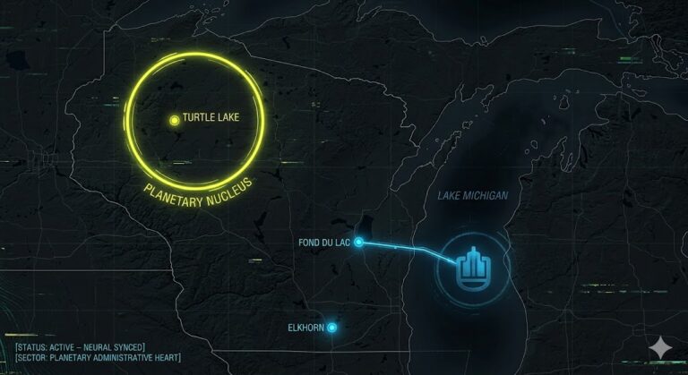
Wisconsin Underground “Beneath the quiet shores of Turtle Lake and the ‘Weather’ masks of Fond du Lac, the ‘Neural Shield’ is pulse-syncing. Wisconsin isn’t...
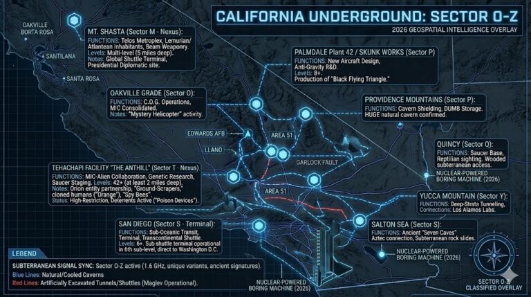
California Underground O-Z “From the 42-level deep hive known as the ‘Anthill’ to the high-speed maglev shuttles of San Diego, the California O-Z grid...
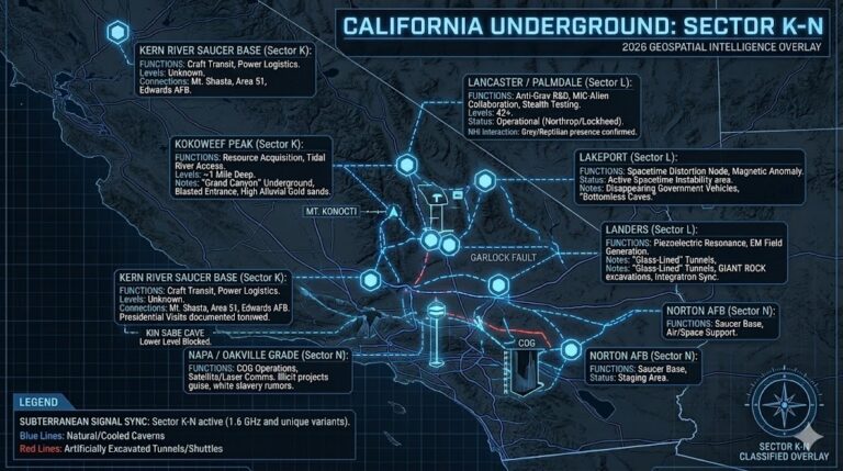
California Underground K – N “Beneath the surface of the Golden State lies a 42-level deep secret: A high-tech collaboration between the military-industrial complex...

“Those are giant things… they’re here under the surface.” This declassified dossier from the Department of Interplanetary Affairs (D.I.P.) reveals the suppressed transcripts of...